| نصب | ۱.۲ هزار |
| از ۲ رأی | ۵ |
| دستهبندی | ابزارها |
| حجم | ۱۸ مگابایت |
| آخرین بروزرسانی | ۲۷ خرداد ۱۴۰۵ |
| نصب | ۱.۲ هزار |
| از ۲ رأی | ۵ |
| دستهبندی | ابزارها |
| حجم | ۱۸ مگابایت |
| آخرین بروزرسانی | ۲۷ خرداد ۱۴۰۵ |
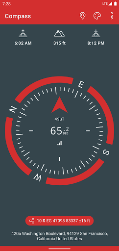
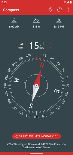
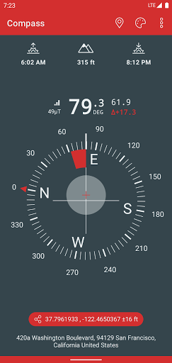
تصاویر برنامه


معرفی برنامه
A simple and easy to use Compass to retrieve useful information about your current position.
• Free and without Ads
• Magnetic & geographic north using magnetic declination
• Sunrise & Sunset time
• Various skins and color themes (including high contrast)
• True altitude above sea level at your current position
• Use EGM96 as the geoid reference for computing altitude
• Latitude & Longitude in MGRS format
• Latitude & Longitude in UTM format
• Latitude & Longitude in DD, DMM or DMS format
• Magnetic field strength
• Sensor accuracy
• Address of your current location
Compass better works outside where magnetic perturbations are low. Magnetic closure cell phone cases may also disrupt the accuracy of the compass.
EGM96 (Earth Gravitational Model) is used as the geoid reference to compute true altitude above sea level from data collected by the GPS sensor. UTM (Universal Transverse Mercator) is a system for assigning coordinates to locations on the surface of the Earth.
Have fun !
