- Applications
- Tools
GPS Tracker, Location & Map


Images

Introduction
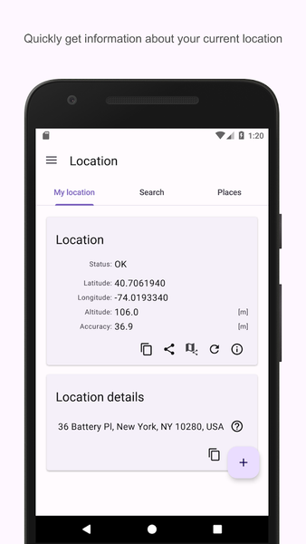
GPS finder helps you find, save and share locations, record your walks, hikes, runs and rides as GPS tracks, and browse everything on a built-in interactive map. No account, no sign-up — your places, tracks, photos and notes stay on your device.
Read your current GPS coordinates or address, share them with anyone, get directions, or look up any place. Save the spots that matter, add photos and notes, organize them with colourful emoji tags, and see them on a real map with markers and switchable layers.
FIND & SHARE LOCATIONS
• Read your current GPS coordinates or address
• Share your location as coordinates or an address
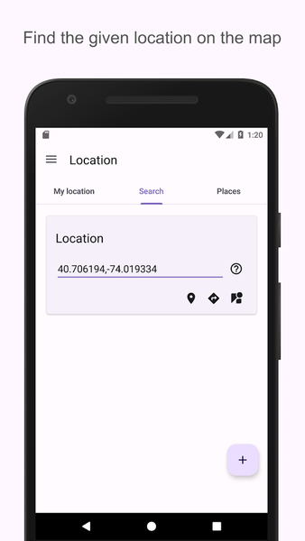
• Look up any place and show it on the map
• Get directions to a location, or view it in Street View
• Works with both Decimal and DMS coordinate formats
• View your current altitude
SAVE & ORGANIZE PLACES
• Save any location as a place with its own title and address
• Add photos and notes to a place — stored only on your device
• Tag places with emoji labels — Home, Work, Hiking, Beach and more — and filter by tag
• See the distance from where you are to any saved place
MAP VIEW
• Browse all your saved places as markers on an interactive map
• Long-press the map to add a new place there, or navigate to that exact spot
• Tap a marker for details, directions, or to edit the place
• Switch layers: Standard, Terrain, Satellite or Satellite + streets
• Filter the map by tag and jump back to your current location
RECORD GPS TRACKS
• Record your route as a GPS track — walk, run, hike or bike ride
• The activity is detected automatically — just confirm or change it when you save
• Watch your track live on the map as you go
• Mark spots along the way (waypoints) with photos and notes, and find your way back to the start
• Review distance, duration, speed and elevation gain/loss on an elevation chart
• Save your tracks and reopen them any time — each shows its date and time
• Pick your GPS accuracy: High, Balanced or Battery saver
SHARE, EXPORT & IMPORT TRACKS
• Share any track as an image to send to friends
• Export a track as a GPX file to open in other apps
• Import GPX files from other apps and view them as tracks
OUTDOORS LOG
• See your totals for distance and time by week, month or year
• Browse previous weeks, months and years
• Drill into any month to see the tracks behind the numbers
• Activity breakdown across walks, runs, hikes and rides
EMERGENCY
• Reach emergency services fast — an SOS shortcut right on the location screen
• One tap opens the dialer with your local emergency number (911, 999, 112, 000, 111…), chosen automatically for your country
• Your live GPS coordinates stay on screen to read out to the dispatcher
• Share your location or copy your coordinates in one tap
PRIVACY
• No account required — nothing to sign up for
• Your places, tracks, waypoints, photos and notes are stored only on your device
• No cloud sync and no online profile
MODERN DESIGN
• Material Design 3 with Material You dynamic colours (Android 12+)
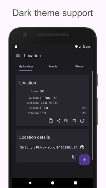
• Dark mode
• Works on phones and tablets
REQUIREMENTS
Your device needs a GPS sensor. Some actions open external apps to handle map content (directions, Street View) — Google Maps is recommended; without a compatible app installed, those actions may be unavailable.
PERMISSIONS
• Precise location — to obtain your current location and record tracks
• Notifications — to show recording status while a track is in progress
• Internet access — to look up addresses, load the map, and handle sharing or external map actions
Privacy policy: https://sites.google.com/view/h4lsoft-pp/main
Related Applications






Users Also Installed